Understanding the Innovation
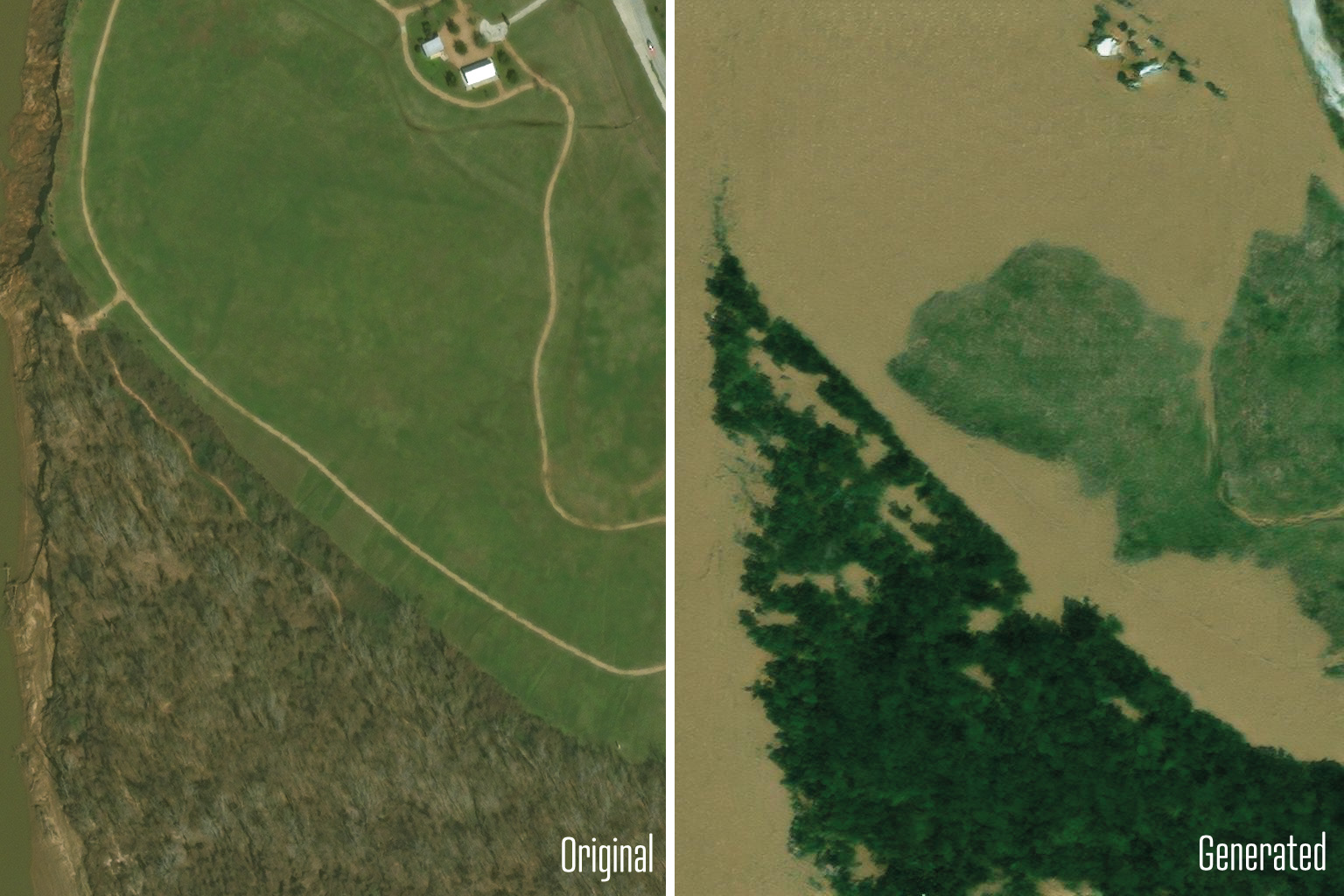
Researchers at MIT have developed a groundbreaking method that uses artificial intelligence to create realistic satellite imagery of potential flooding scenarios before hurricanes strike. This innovative approach combines generative AI with a physics-based flood model, allowing residents to visualize how their neighborhoods might be affected by an impending storm. By generating images that show the likely extent of flooding, this tool aims to help individuals make informed decisions about evacuation and preparation. The method was tested in Houston, simulating a scenario similar to Hurricane Harvey and comparing the results with actual post-storm satellite images.
Key Features of the Method
- The technique produces high-fidelity satellite images of future flooding, enhancing public awareness.
- It integrates a conditional generative adversarial network (GAN) with a physics-based flood model for accuracy.
- The AI-generated images were validated against real satellite images, revealing improved realism over traditional methods.
- The project, called the “Earth Intelligence Engine,” is available online for public use, promoting community engagement.
Significance of the Research
This research highlights the potential of merging AI with physical models to create trustworthy visualizations for disaster preparedness. By providing localized and realistic flood predictions, this tool can directly impact evacuation strategies and public safety. It represents a significant step forward in climate communication, making complex data more relatable and actionable for communities at risk. As climate-related disasters become more frequent, having reliable visualization tools can empower residents to take necessary precautions, potentially saving lives and reducing damage.