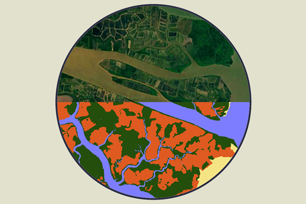
Overview of the Innovation
A research team at the Clark Center for Geospatial Analytics is breaking new ground with a generative AI model designed to predict land cover changes over the next two decades. This innovative tool allows homeowners, policymakers, and researchers to visualize potential future scenarios for their landscapes based on various external factors. The project is led by Hamed Alemohammad, who collaborates with NASA and IBM to enhance the capabilities of geospatial analysis through the Prithvi model, the first of its kind in the field.
Key Features of the AI Model
- The model can simulate different scenarios by allowing users to input variables such as population growth and economic development.
- It learns from historical land cover data to generate accurate predictions about future changes.
- Decision-makers can use the model to create maps that illustrate the impact of policies and regulations on land use.
- Funded by Taylor Geospatial Institute and AWS, the project is part of a challenge to foster innovation in geospatial data applications.
Importance of the Development
This generative AI model is significant as it provides a proactive approach to understanding land use changes. Traditional methods have focused on past data, leaving a gap in predicting future risks. By offering insights into how landscapes might evolve, the model empowers communities and authorities to make informed decisions. This capability is vital for urban planning, environmental protection, and disaster preparedness, ultimately contributing to sustainable development practices.